By the late 1940s, the breakwaters that had been intended to provide deeper water for boats had instead served to collect the drifting sand and close the channel beside the lighthouse. With larger, motorized boats, Red Head Harbour was constructed along the bay and the lighthouse site was abandoned to the elements.
Banner image: Postcard of St. Peters Harbour Lighthouse from the PEI Postcards Collection, UPEI Robertson Library. Undated. Given photos below, it would appear to be circa 1950.
Banner image: Postcard of St. Peters Harbour Lighthouse from the PEI Postcards Collection, UPEI Robertson Library. Undated. Given photos below, it would appear to be circa 1950.
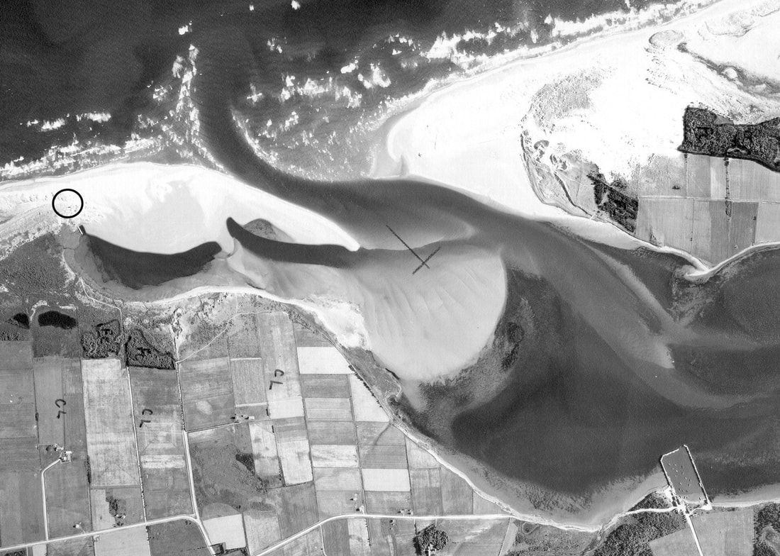
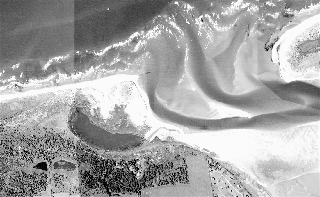
Aerial photo survey of St. Peters Harbour, 1958.
The western channel beside the lighthouse (circled) has been closed in by sand, the eastern breakwater is not visible, and the new Red Head Harbour appears at the lower right.
Image courtesy National Air Photo Library, Natural Resources Canada.
|
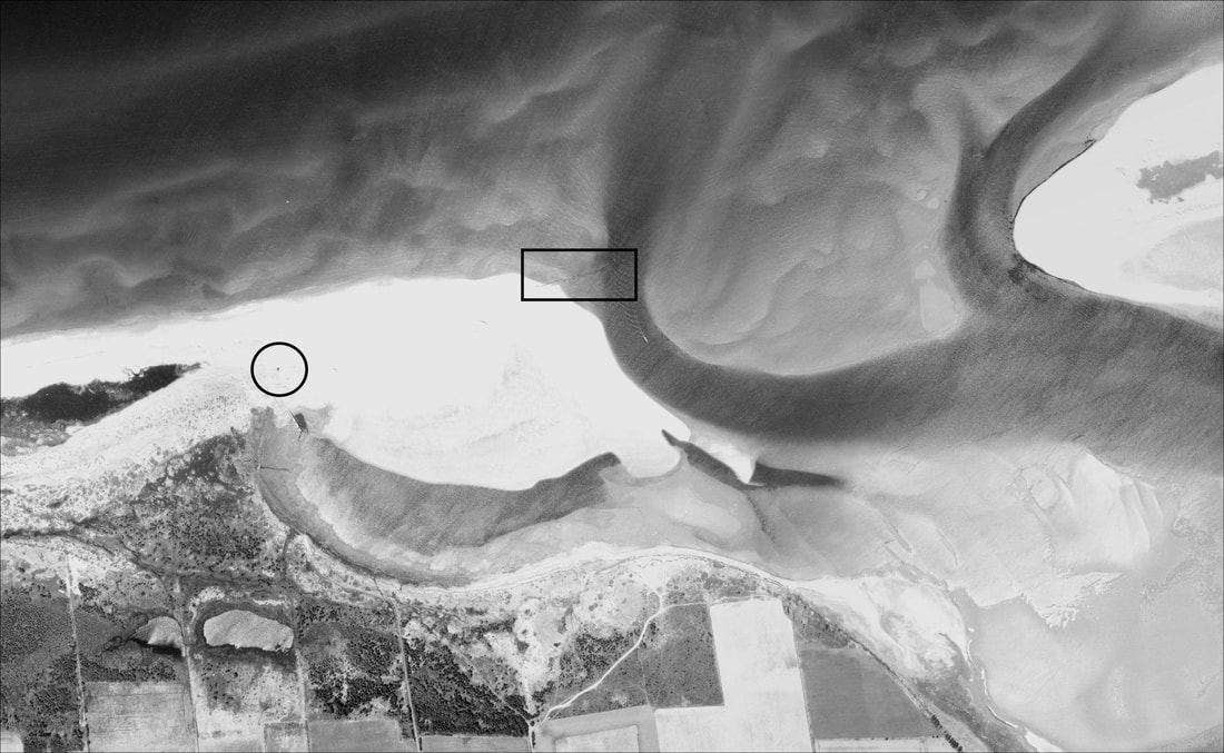
Aerial photo survey of St. Peters Harbour, 1968. Lighthouse location circled, and the eastern breakwater is visible at the end of the sandbar, to the left of the channel (rectangle). Image courtesy National Air Photo Library, Natural Resources Canada; image capture with ArcGIS, georeferenced by the UPEI GeoREACH Lab.
|
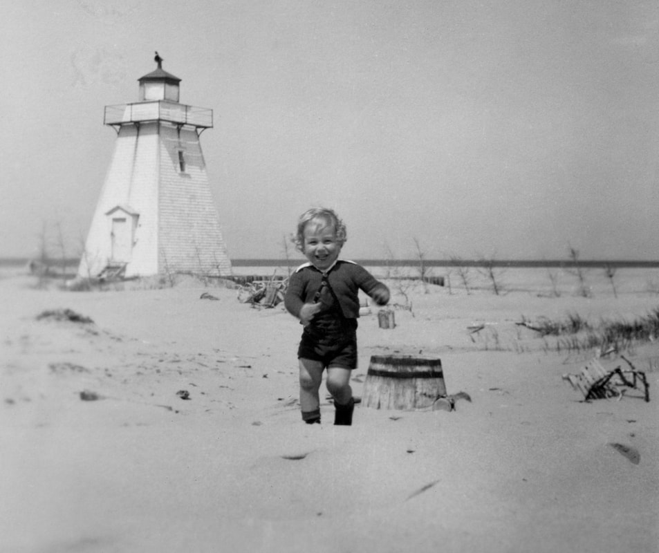
Photo courtesy of Dennis Taylor, dated 1948. It looks like there is still a channel behind the breakwater, but the wharf had already been abandoned (although Red Head Harbour would not be opened until the 1950s).
|
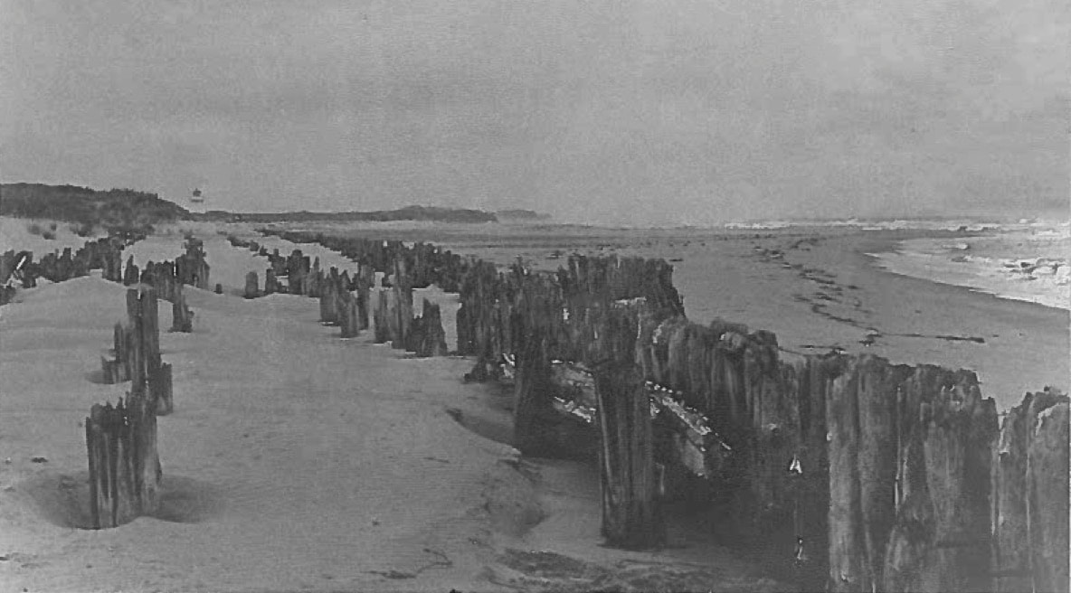
Extent of original east breakwater. Photo: Terry Chapman collection, undated. Given the visibility of the lighthouse and extent of the breakwater, this was likely taken between 1970 and 2000.
|
By the turn of the new century, farms had been turned to recreational property and Lighthouse Road extended to the front lighthouse tower. A portion of the eastern breakwater had been removed to allow for navigation, and the western breakwater and a section of the wharf were buried in sand dunes.
|
|
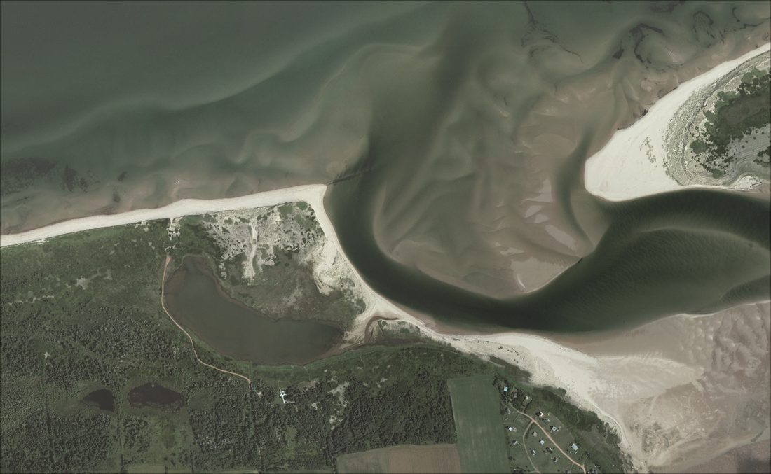
Aerial photo surveys of St. Peters Harbour, 2000 and 2010. Note scar from removed breakwater with new channel to the right, and new road extending to lighthouse. Images courtesy Government of Prince Edward Island; image capture with ArcGIS, georeferenced by the UPEI GeoREACH Lab.
For further reading:
- Joshua MacFadyen, Swallowed by the Sea/shore, Network in Canadian History and the Environment (NiCHE), 2013
