Banner: Wharf at St. Peters Harbour, circa 1935. Terry Chapman collection. Note open channel to right (east) of lighthouse.
|
|
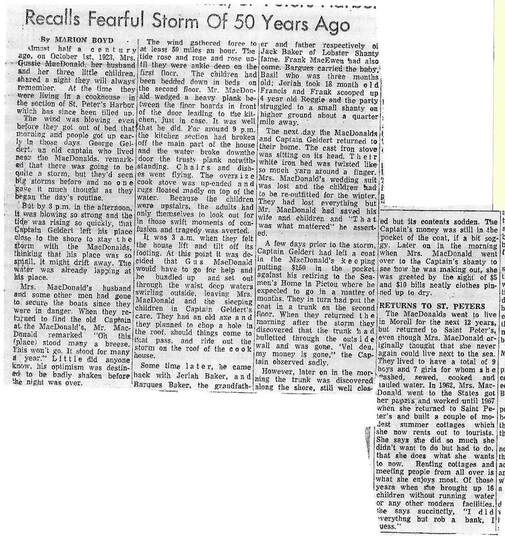
Left: article by Marion Boyd about the Category 2 (equivalent to Hurricane Fiona) that hit PEI on Oct. 1st, 1923. Clipping courtesy Danny Geldert.
Right: short story by Frances Macdonald (Fran Griffith) based on the same storm of 1923. In it she mentions that all the wharves were destroyed.
With thanks to Skip Macdonald, Maureen Ledwell, Anne Macdonald, and Ian Rowe.
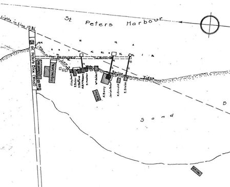
Plan of St. Peters Harbour, circa 1931/2
Upper left indicates line of lights from front lighthouse at end of breakwater to temporary rear range light.
Breakwater is listed as "West", implying East (unfinished) breakwater.
Wharf is only proposed at this point, with appropriate shack relocations.
|
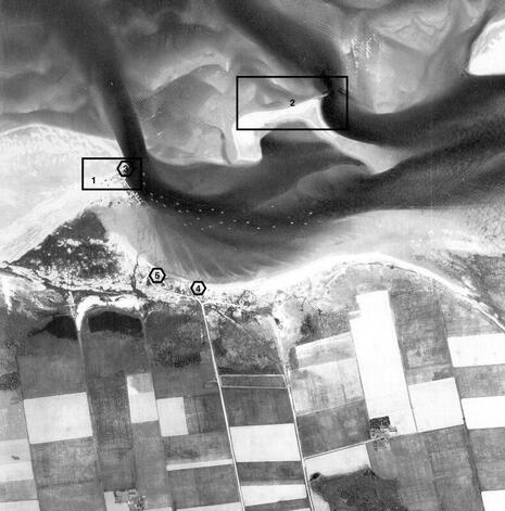
Aerial Photo Survey of Prince Edward Island, 1935 Flightline 5331, Photo 57 1. First breakwater and reinforcement, 1878, extended 1904. 2. Abandoned 1883 breakwater remains. 3. Front/Outer (remaining) Lighthouse. 4. Location of Rear/Inner Lighthouse, 1922. 5. Likely location of Rear/Inner Range Light, 1935. Note also the farmstead at bottom right-centre, marking the high point of land where the Acadian Church once stood and later Stukely Farm. Greenwich at top right is mostly sandy beach. Image courtesy National Air Photo Library, Natural Resources Canada, image capture: ArcGIS, georeferenced by the UPEI GeoREACH Lab. |
|
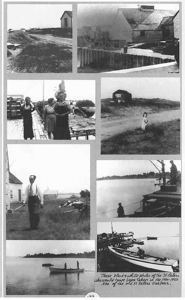
Page from the Terry Chapman collection. Second image left: George Geldert in the foreground with Claire & Donnie Geldert (woman unknown).
|
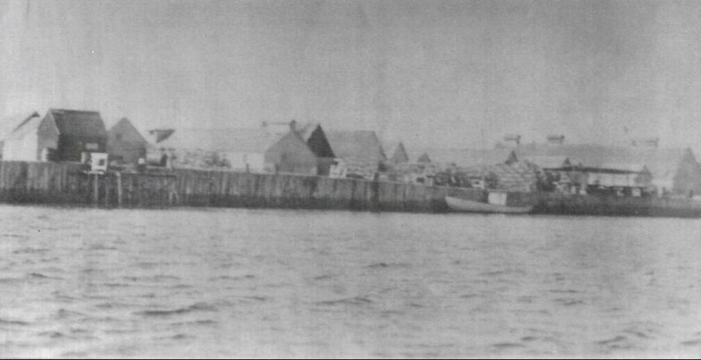
Wharf at St. Peters Harbour, likely same date as banner (post-1931)
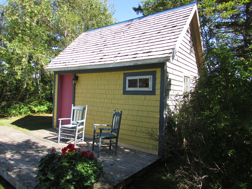
Re-purposed bait shack from St. Peters Harbour, purportedly in the original colours. Thanks to the Rowes of Shady Lane B&B.
|
