Banner image: extract from Meacham, J.H. & Co. and C.R. Allen. “Plan of Lot Thirty-Nine, Kings Co., P.E.I.”, 1880, p.98. "St. Peters Harbour" appears for the first time, lower on the map. UPEI Island Imagined
.
.
As the fishing and canning industries take off in the mid-1800s, the fishers start campaigning for a better channel across the sandbar and permanent lights to mark the channel. Two range lights are finally erected in 1878, with the front range light standing on the end of a newly-constructed breakwater on the west side of the bay.
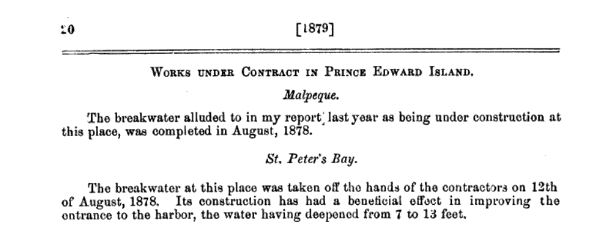
Dominion of Canada, Annual Report of the Minister of Public Works, 1879*
|
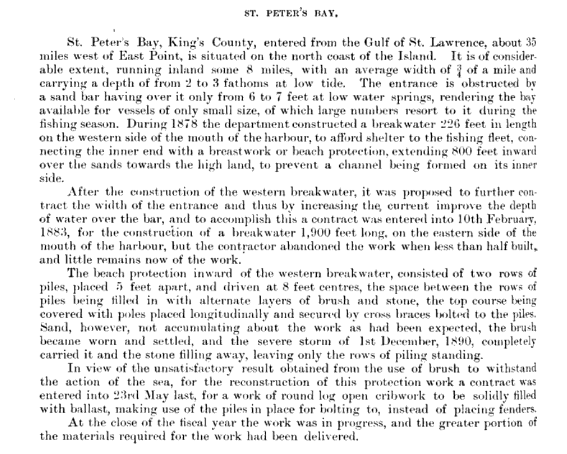
Canada, Annual Report of the Minister of Public Works, 1890-1891*
|
|
|
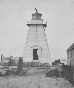
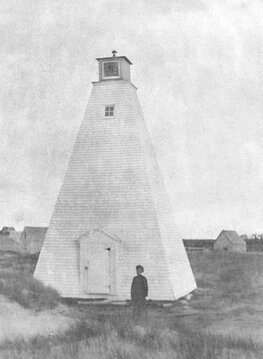
Front (outer) and Rear (inner) Range Lighthouses, 1917. Note open water behind front lighthouse, which is today is surrounded by sand dunes.
Images: Canadian Coast Guard, from https://www.lighthousefriends.com/light.asp?ID=943.
Images: Canadian Coast Guard, from https://www.lighthousefriends.com/light.asp?ID=943.
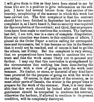
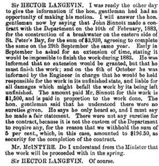
Buoyed by the apparent success of the first breakwater in increasing the depth of the harbour, a second, longer breakwater is planned for the west side of the channel, connecting to the Greenwich peninsula. John Sinnott starts the east breakwater in 1882 but abandons it after winter storms. Despite concerns that the harbour would be destroyed if the breakwater wasn't completed, portions of the second breakwater still stand 140 years later at the mouth of St. Peters Bay.

From the Annual Report, Department of Public Works, 1882-1883*
extracts from pages 1220 and 1221 follow*

|
|
After multiple moves of the rear lighthouse due to the changing channels, the tower lights are replaced by temporary range lights in 1921, and the rear lighthouse disappears some time later.
|
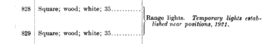
|
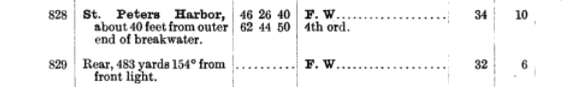
From the List of Lights, The West Indies and Pacific Islands and Coasts of North and South America
Excepting the United States Issue 30, Volume 1, 1922. United States Hydrographic Office. Source: Google Docs
Excepting the United States Issue 30, Volume 1, 1922. United States Hydrographic Office. Source: Google Docs
For further reading:
- Juanita Rossiter, Gone to the Bay, 2000.
- lighthousefriends.com: St. Peters Harbour Lighthouse
- Edward MacDonald and Boyde Beck. “Lines in the Water: Time and Place in a Fishery” in Time and a Place: An Environmental History of Prince Edward Island, 2016,
* all government reports sourced from Google Docs
